Community-engaged programming is one of the biggest trends of the past decade in museums and cultural institutions. Inviting locals to participate in workshops and contribute to collections is becoming increasingly common, and it’s obvious that this engagement bolsters an institution’s impact: the evidence is usually visible right at the ticket desk.
It can be less obvious, for programmers looking to initiate new community outreach, where to start. Who are the local business owners you need to get on board with a new project? What was that diner that everyone used to love, and do they still cater? Where do the elders of the neighborhood tend to get their information?
These are the kinds of questions that curators at MoMA PS1 in Long Island City, New York, were asking as they sought to engage the public in a revitalization of the 1892 building’s courtyard space in 2021. Architecture and urban planning professor Cara Michell was invited to join the group of architects initiating the project to facilitate conversations around new uses for the courtyard, bringing in cohorts of diverse stakeholders to give their input.
With a practice based in geography, Michell thought right away of an approach that would bring all this intangible knowledge to the surface: making a map.
“I said, it would be great to have an ongoing, consistently updated map of the social assets in the community,” says Michell, who is also a senior urban planner at WXY Studio in New York. “So whenever they want to do community-engaged programming in the future, they’ll know who to reach out to.”
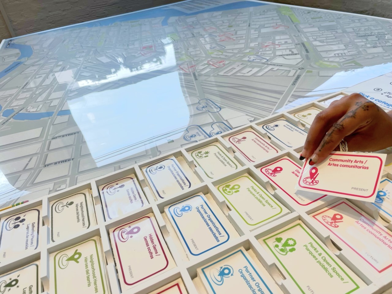
Michell’s proposal became a physical map and series of workshops, with a report on the findings, all presented as part of the installation “Courtyard Coalition” showing from through November in the museum’s “Homeroom” space, which focuses on community-centered art. On August 27, Michell will host a participatory session for community members to contribute to the map.

The map itself was fabricated in a thick, durable vinyl, with clear mylar sheets to go over the top and be filled with writing and stickers, which are delineated both by category and time.The categories include both brick-and-mortar spaces and “psychogeographic” spaces, like memories and hopes for the future.
There’s a playfulness, says Michell, when you give people the freedom to dream in the context of a real place. “Some kids came in and were like: ‘bouncy castles, that’s what we want here’” she says. When a mylar sheet of community input fills up, it can be removed and replaced with a fresh one, providing a temporally-based “stacked archive” for each stage of the program.
The participatory project aims to acknowledge the gentrification of the area surrounding PS1 and the resulting displacement while also focusing on the future. “It wasn’t about observing the community through this Panopticon,” says Michell. “It was about learning from the community.”
Back in Boston, Michell is applying principles of participatory mapping to explore how experiences of racism are embedded in physical architecture through a research project with Center for the Arts director Juliana Rowen Barton, architecture professor Nicholas Brown, and art and design and theatre professor Sylke Meyer. The team is working with high school students at 826 Boston in the university’s Roxbury neighborhood, to create a walking map of their experience, combining practices of curation, urban planning, movement, and improv together.
That interdisciplinary approach has Michell excited for the future of participatory mapping, which she notes has benefits beyond the final map: “It’s more about trust-building, tracking the process, and what we’re learning from each other than it is about any sort of final output.”


